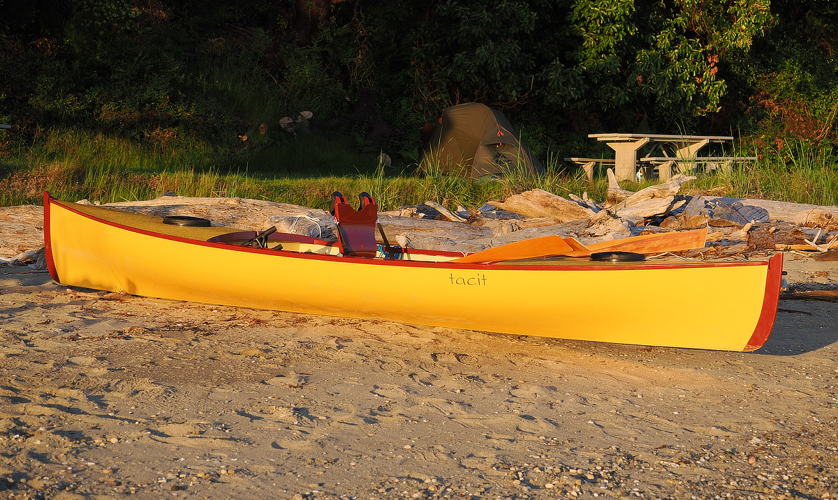
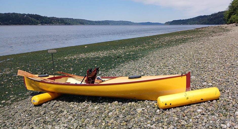
I built a swift little rowboat. And an absurd number of people who see it ask “Are you going to do the Seventy48?” a human powered boat race from Tacoma to Port Townsend, covering 70 miles, with a 48 hour limit, with winners under 10 hours.
No, I answer, it’s cool, but not my thing. I prefer to leisurely explore a coastline, go with the flow, take long walks in wooded trails, do photography, and be easier on the bod.
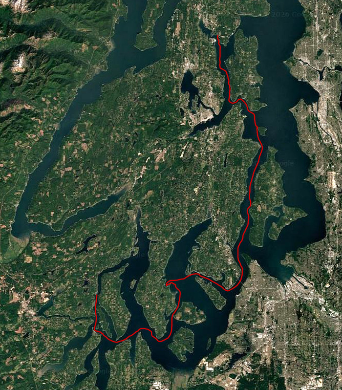
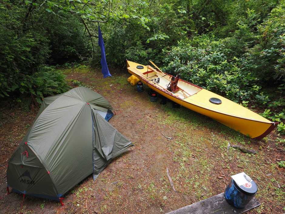
So that is just what I did, and what a wonderful time I had. In May of 2026 my wife dropped me off near Shelton WA, on the southwest end of the Puget Sound, and I set off in my newly built boat, packed with 10 days worth of camping gear and grub.
My intention was to row all the way back to Port Townsend. But a small craft warning of high winds, right when I was going to transit a notoriously nasty spot of water, prompted me to end the trip a few days earlier at a friend’s beach house in Poulsbo, which ended up being perfect.
Table Of Contents
Good Little Boat
Nights 1 & 2 – Hope Island Marine Park
Navigating Tides & Currents
Nights 3 & 4 – Penrose Point State Park
Lower High Tide?
Night 5 – Lisabeula Park
Nights 6 & 7 – Blake Island
Day 8 – Poulsbo
Thoughts On The New Boat

A Good Little Boat Lets You Hear A New Song Of Nature

Friends and family rib me when I get or build a new boat, as though it's a self-destructive addiction. They don't really understand what the experience of a new boat means to me. I love exploring in beautiful little craft. But it is how the world sings through them to me, that is their true delight. Plying the waters in a good little boat is like growing an extra sensory organ through which new symphonies of the natural world are revealed, and not just any tunes, songs that make my heart soar and sooth tempests. Is it any wonder that a new little boat gets my heart racing?

Dingy sized sailboats are particularly good at this. Sail cupping wind high in the bright, centerboard and rudder spreading ocean deep, hands listening to sheet and tiller, with a quiet but attentive mind; there is a new perception, wind uncomfortable, restrained, pressing, ocean parted into currents unusual, resisting, both plying to and fro in curious harmonic argument, this fresh music of sea, wind and self, evidenced through the surge, pull, roll, whistle and groan of this good little boat.

And here I find myself in this extraordinary new boat for over a week, a rowing craft like no other. A boat I dreamed about, drew, swore at and labored over. A fine instrument for singing of currents, wind, wake, and sore muscle. What will it be like? Will all of my design ideas work out?
Nights 1 & 2 – Hope Island Marine Park – 5 Mile Row
I started at Latimer’s Landing, a public boat ramp right next to the bridge to Harstine Island, on Pickering Passage. Before launching the water currents were ripping north at a few miles per hour, leaving a hole of water behind the bridge pillars. Unnerving, since I planned on rowing south about five miles, to Hope Island. My divining of the water oracles said the ocean would change its mind soon. And sure enough, with boat packed and ready to set out, the current slowed to almost still.
Then a wind from the south picked up, making the five mile row to Hope Island a bit of a long slog, although a very enjoyable one, with eagles and osprey soaring overhead. Harbor seals popped their heads up all around, curious I imagine about what this yellow water bug was, splashing above them; although they are color blind. The temperature was in the lower 70s. Perfect. The last time I was here in May the temperature was in the 90s.
I kept clipping the wave tops with my new oars, splashing myself, but it did not matter, as I dried quickly. I was still getting used to the pinned oarlocks on these new oars. This type of oarlock stays attached in place on the oar, captured with a pin through the shaft, as compared to an oarlock that is loose around the shaft.
The main disadvantage of the pinned oarlock is that you can’t rotate the blade angle, a process called feathering, to allow it to move easier through the wind and wave tops on the return stroke. So they are generally disdained here on the left coast. But they are the superior choice for this boat, for a few good reasons. In fact Adirondack Guideboat oars (the design origins of my boat) are very unique compared to the oars for all other craft, much like the boat itself.
Oars are to a good rowboat what a fine bow is to a premium violin, essential for coaxing the best tone out of the instrument. I had two pairs with me. One set shorter and stiffer, for upwind work. The other set longer and more flexible for downwind.
Hope Island Marine State Park is a little treasure. I almost want to lie to you about it, to keep you away, to hoard it for my future use, to tell you it is rife with rude noisy campers, aggressive raccoons and boredom. But I can’t. I love it, particularly on a weekday, early in the season, when there are only a couple of other campers and one ranger on the island.
I did not see a raccoon on the island, which was dang odd. Another camper who had visited the last 14 years in a row said he normally has 50 sightings of them, and also had not found them. He arrived by canoe with all his camping gear, son, and a giant steel cylinder that he was using to support the hole while he dug Geoducks. He did see signs of a big cat on the island, prints in the sand, big hair filled scat, as did I, which had me looking over my shoulder a bit on the trail.
Then again, maybe a disease had hit them, because nearly every campground on this trip had a reputation of aggressive raccoons, and I did not see one. Which was oddly annoying, because just before leaving I had spent a small fortune on three bear proof canisters for my food, to keep these intelligent, greedy handed, mini-bear trash pandas out of my food. Bear Vault. All they did was make it really hard for me to get at my food. Should be called Human Vault. Those frustrating lids took some figuring and lube.

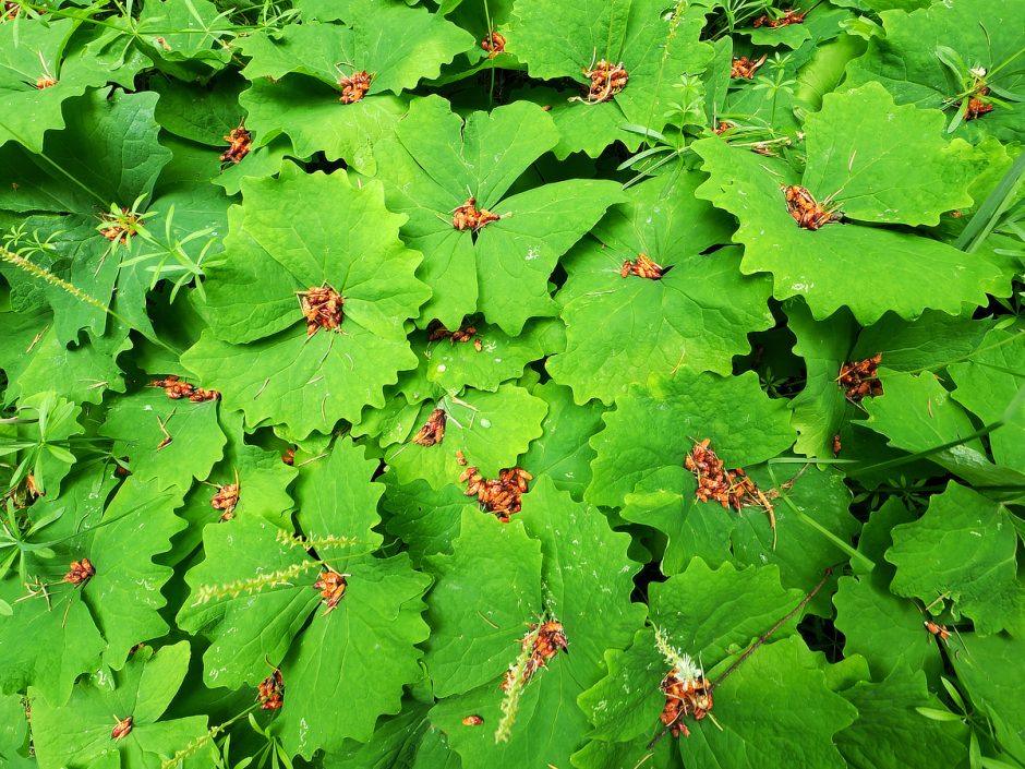
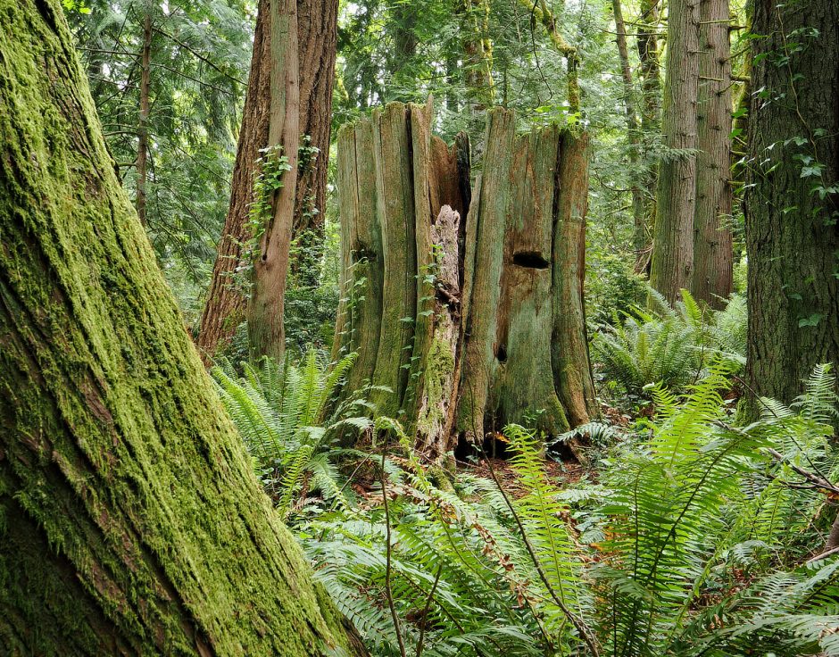
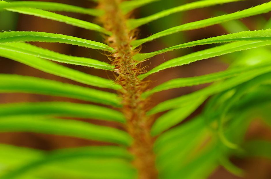
Hope Island is not big, but what I enjoy most about it are the forests, and the lovely trail that winds around it. The island hints of a better past, with some truly giant old growth trees still present, and lovely groves of newer growth to enjoy as well, blanketed in Vanilla Leaf ground cover wearing necklaces of orangish-red fir tree pollen cones.
The Ranger Station cabin sits in a little clearing, with a windmill powered well, solar panels, small gardens, and an heirloom apple orchard. I salivated at the thought of living there.
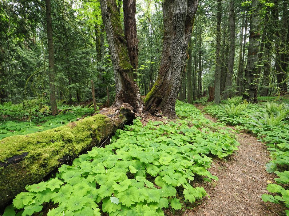
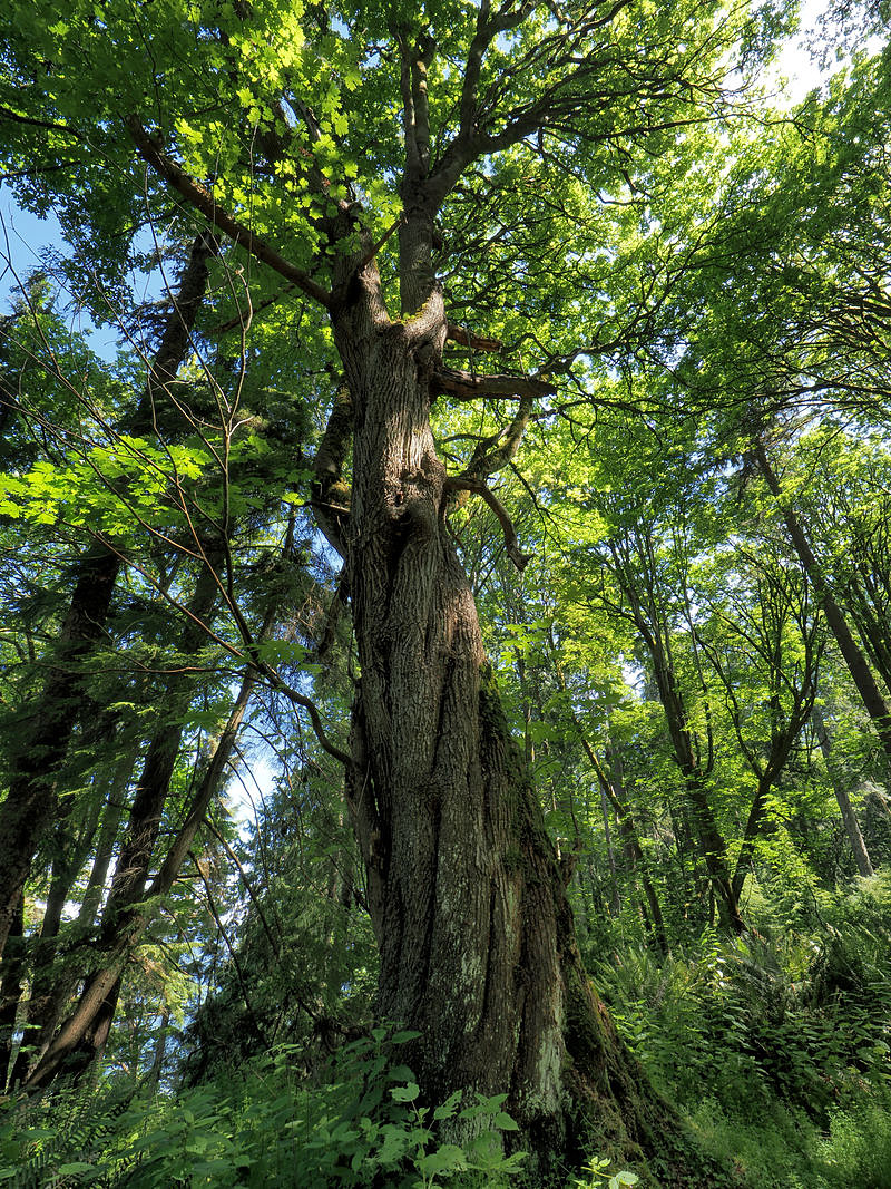
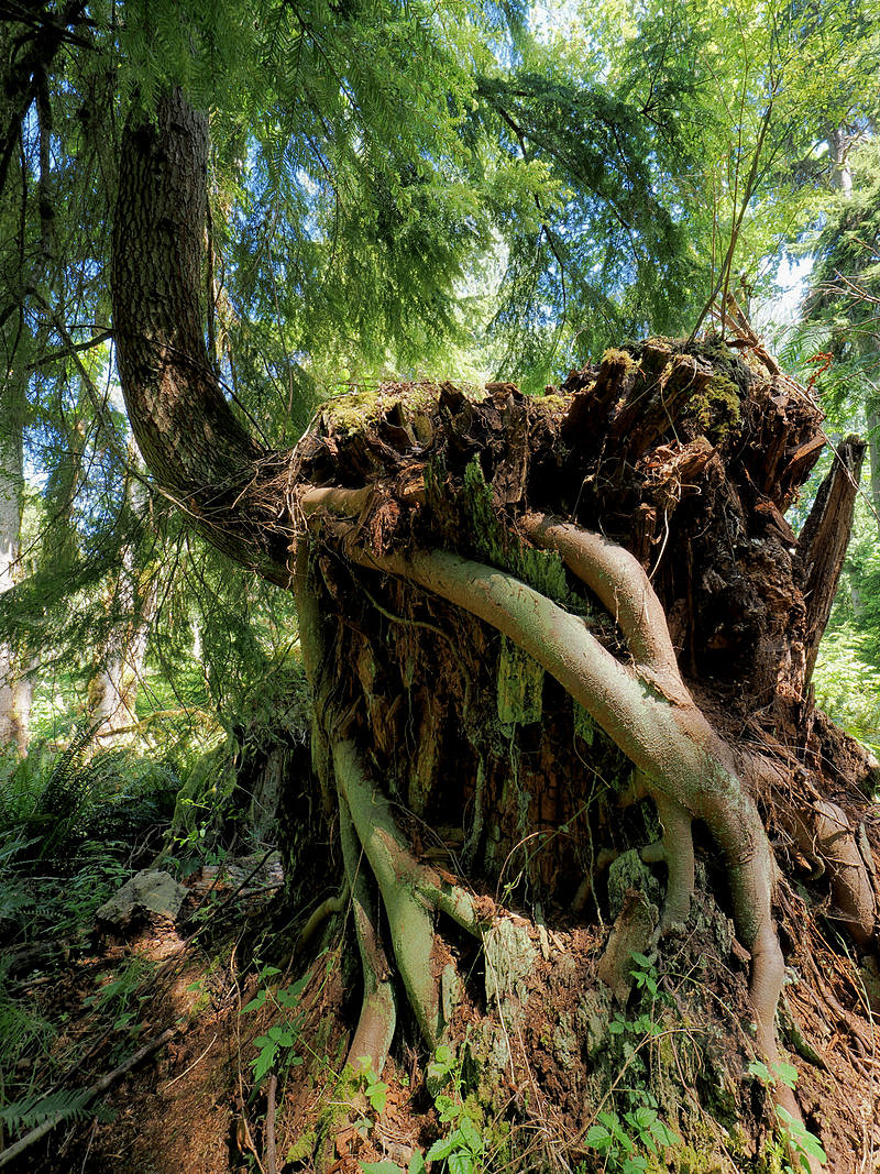
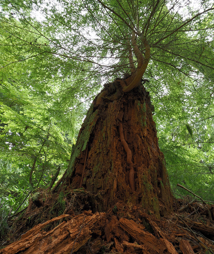
Giant old growth trees hold such a majesty and weight of presence, that I feel very young and small among them. Have we cut them all down in part because they make plain our insignificance in stature and time? I find it inconceivable to cut one of these giants down. I am too awed by them, too reverent. A hypocrisy. Building our home I have cut down many of their children, chainsawed them all up, burned them in the wood stove of my workshop, while building boats out of marine plywood made from other ancient giants from rain forests afar.
Uptight Douglas Fir trees grow so straight, and hold such a consistent diameter high into the air, that they must be a lumberman’s dream. Our local Douglas Fir is a wonderful strong wood for building, and decent firewood also.
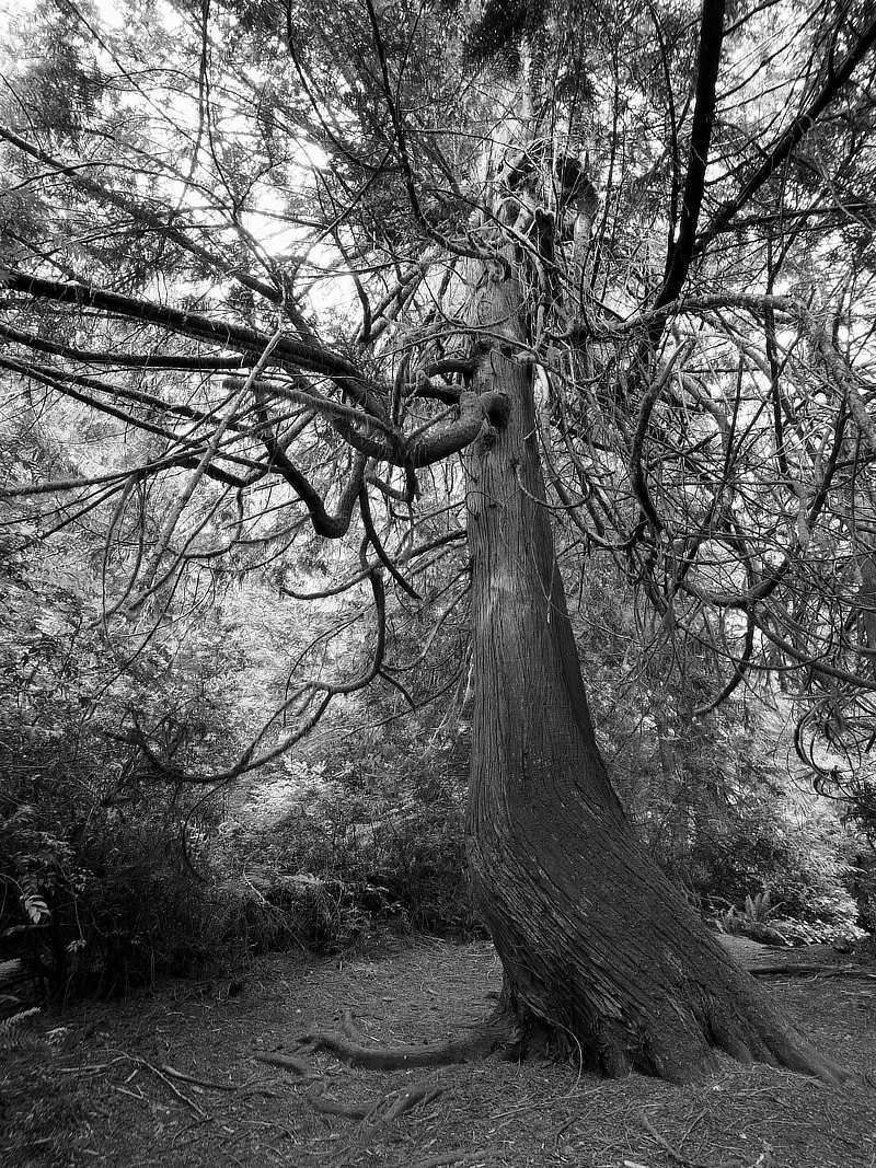
Old growth Western Red Cedar giants have more of a gradual taper from the base of their trunks to the top, a long slender cone that is mirrored in their canopy. The ancient ones appear clad in great grey beards, their silver bark. The wood is very lightweight but still fairly strong, coveted for planks of fleet craft, and favored for dugout canoes by natives.
Big Leaf Maple likes to start out with a big central trunk, often knurled with burls, which quickly branch off into several major limbs supporting a broad canopy of big green leaves, which I find rather magical to look up into from the gifted shade below.
Madrona trees were also common this trip. Crooked in nature, never growing straight, so full of twisted muscle, they are safe from the lumberman, laugh at the axe. They sidle up to other trees and sneak through to steal sun. Snake-like, they shed their papery skin revealing smooth red bark. Add drug dealer to their rap sheet. I watched a bee wrapped around a fallen Madrona flower on the beach, rolling around frantically in the sand in some form of ecstatic high.

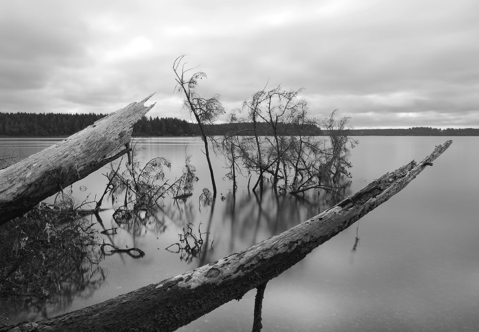
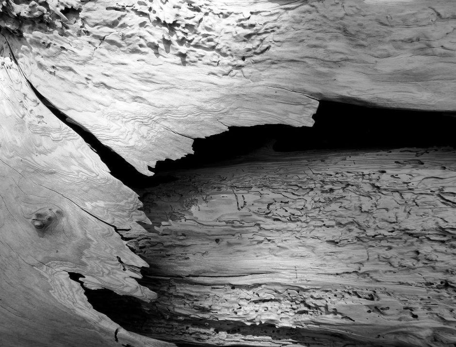
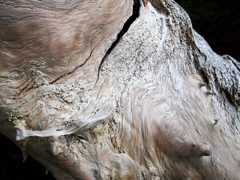
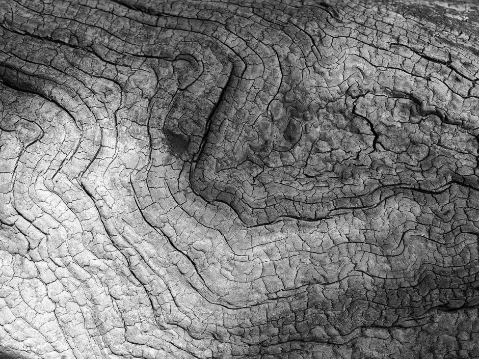
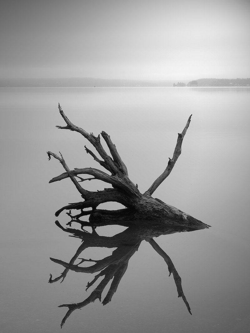
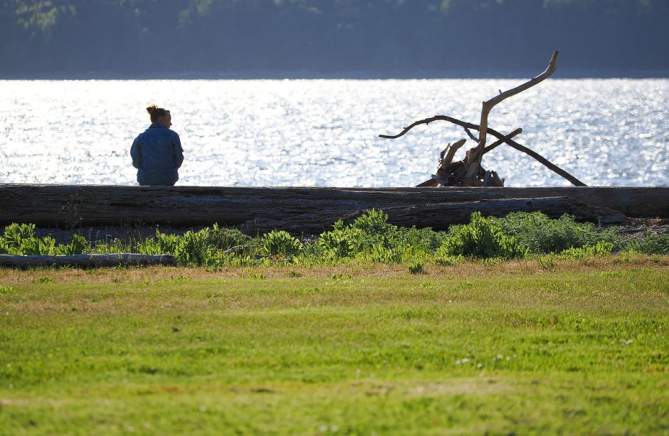
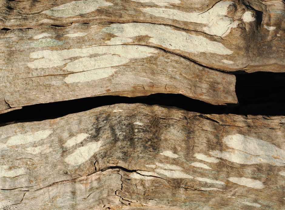
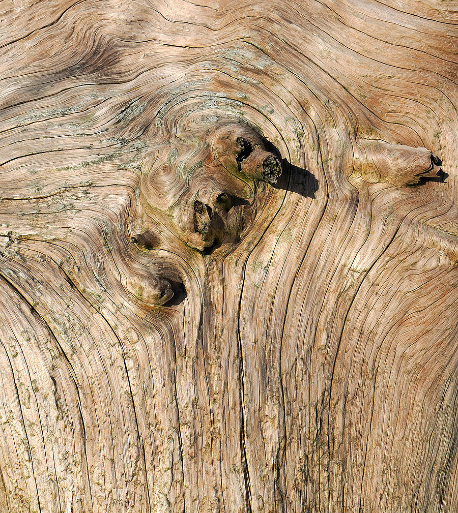
The shorelines of Hope Island were rife with mysterious beach logs.
Hope Island is not perfect. Just across the water to the south is a hillside barnacled in homes, Carylon Beach, which should be renamed Noiseville; barking dogs, cars, generators, people yelling at each other. Tiny Steamboat Island, also just to the southwest has a certain charm, a turtle back ferrying as many homes as it can, the current rushing around it so swift it sounded like a roaring river in my tent in the middle of the night.
Close across the water to the northeast lies Squaxin Island, part of a native reservation. An entire island with no visible development. Natural coastlines, trees and quiet. Well, the eagles are not so quiet, screaming at crows pestering them.
Sitting in the middle of time on Hope Island, the future to the south; the Squaxin tribe have the right of it.
I had originally planned on breaking camp almost every day, rowing and visiting a new campground each night. But I had a very strong desire to stay another night on Hope Island. It was so peaceful, the temperatures perfect, the mosquitoes lazy, the air so fresh with a hint of marine brine spicing it up.
So I spent another night, and followed that pattern as often as I could for the rest of the trip, rowing a bit further between campsites. The no-travel days allowed me to recover from the rowing effort, and gave me time to explore and do some photography. I had brought along a new camera, with over 600 settings to learn, and was having a great time with it. An added benefit to changing my travel plan was leaving a number of parks unvisited, to explore in the future.
Navigating Tides & Currents & Wind
Each night I camped at islands and shoreline parks along the Cascadia Marine Trail, rowing between. The satellite view might fool you into thinking this is like easily crossing some lakes. But the Puget Sound is more akin to an ornery river with a split personality that can't make up their minds which way to flow.

My trip began during a new moon, when it gangs up with the sun to create extra high and low tides. From a high tide of 14.5 feet, the water would drop to a negative 4 foot, a vertical change of 18.5 feet. This colossal amount of water leaves and returns through the shallow and narrow channels of South Sound, creating rivers of water flowing two to five miles per hour in narrower areas. My boat, loaded up as it was, cruises at 3.75 mph. That is fast compared to some. But against a moderate current I could be working hard and sitting still.

As much as possible, I enjoy harmonizing with the current flows, participating flotsam. That's my nature. Some enjoy pitting themselves against wind and water, proving their strength. No matter how you float your boat, there are things to learn, songs to be heard.

It's easy to know exact high and low tide times for each area. But the currents are not so easy to predict. Some channels nearly always only flow north, in rising and dropping tides, which is weird. Sometimes there will be a current going one way on one side of a channel, and the opposite just across the way. And current directions and speeds don't line up with high and low tides like I might think. There are delays, complexities. Local knowledge is king. Some apps and websites help in the daily planning.

I was also watching wind forecasts, with careful attention paid to any that might blow against the current direction. That can build up nasty big waves that might be dangerous for a small craft.
Night 3 & 4 – Penrose Point State Park – 18 Mile Row
I left Hope Island early in the morning. I could have stayed later and had a stronger current going with me. But Penrose Point State Park was my next destination, and Mayo Cove, fronting the park, is very shallow, and on negative tides there would be a long stretch of shoreline that I would have to haul my boat up, so I wanted to beat the lowest tide.
Besides, I love early mornings on the water. The winds are normally light. Marine life is active. Humans and their noisy wave machines are nearly all abed. The world and I have each other.
There was a little breeze blowing up out of Eld & Budd Inlets from the south, as I rounded the southern ends of Squaxin and Harstine Islands. I entered Dana Passage, a place that can be bumpy from strong currents, to find it calm, the water flowing my way. I cut diagonally across Dana to Johnson Point, passing the entrance to Henderson Inlet to the south. Johnson Point had a powerful current moving past it, but just around its tip to the east I took a break, captured in an eddy. Next I crossed Nisqually Reach heading for Devil’s Head, crabbing my course northerly because of currents pushing me south.
After a short break on the beach at Devil’s Head, stretching my legs and expelling the morning coffee, I continued on north toward Pitt Passage, another narrow and strongly currented choke point. Along the way I really wanted to duck into Filucy Bay, to explore the nature preserve at the head, but the rowing miles were adding up enough that day. As the current swiftly drew me past the little speck of an island in the middle of Pitt Passage, I was surprised to see a sign on it saying keep off, penitentiary island. Must be a penitentiary for one. I found out that it is associated with McNeil Island to the east, which has a long sordid history as a prison island, its shores off limits with warnings not to pick up swimmers.
All and all it was an enjoyable row, but long, covering 18 miles. And when I arrived at Penrose I still had to haul my boat up 1,000 feet of tidal flat. This trick requires inflatable beach rollers and labor, getting the boat up on the tubes, and pushing it up the shore while keeping it running straight. As one roller at a time exits out the back, I run around and get it started again in the front, over and over. I would like to have first emptied the boat of all gear weight, but could not face all the extra distance walked, ferrying gear bags. I was well and tuckered out that evening.

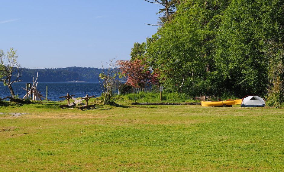
Penrose has a single campsite for those arriving by human powered watercraft, very close to the beach. There is a larger campground further within the park. But after the day visitors left, I had the entire north end of the park to myself in the evenings. It was very quiet.
However, I was ripped from a deep sleep on the first night by a stupendously loud noise that was shaking the ground. My lizard brain explained that there had been an earthquake and a tsunami was coming. Reasonable. I came to peace with my end.
Then the noise and vibration became less, and I realized it was a huge military helicopter that had come close, and did twice more during the night. In the morning I talked to a park ranger. He said it is common. His own old house is often shaking under the assault in the middle of the night.
You know who else are noisy? Birds, singing in the first signs of light at 4:30 am. I was rediscovering how little noise insulation tents offer. At Hope Island there was another camper, who’s tent I had not thought was very close, rotating all night on a camping pad apparently constructed of full bags of potato chips. I returned fire with the loudest old man farts I dared risk.
Penrose has some nice forest trails to walk.
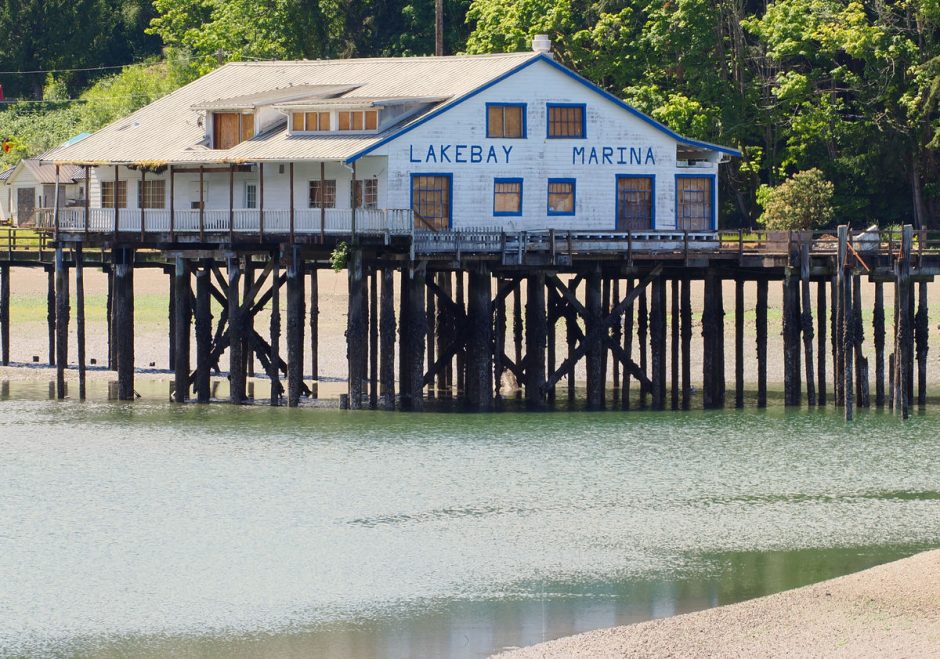
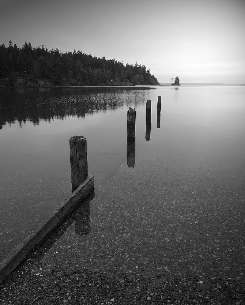
Penrose has a small boat dock tucked around the west shore, in a little protected area of Mayo Cove that nearly all goes to mud during a negative tide.
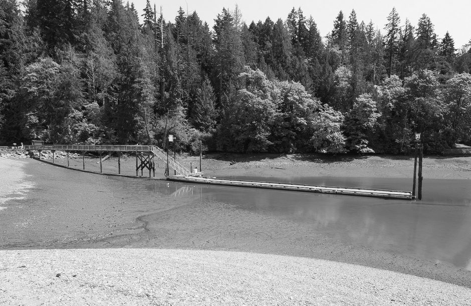
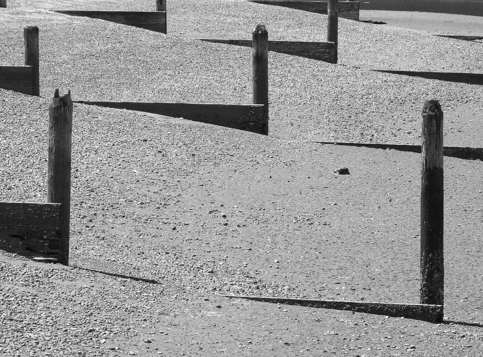
In the same part of the bay is the old Lakebay Marina building, which has been closed for awhile, its docks removed. The State and the Recreational Boaters Association of Washington bought it and began restorations. In the process of cleanup they found a massive volume of contaminated soil from a buried fuel tank, which stalled some progress. Below you can see an expression of tide height changes in the cove.

Penrose has natural feature surprise that I loved. Jutting out into the middle of the bay is a ridge that drops in height so evenly that a trail atop it is almost magically revealed, inch by inch, as the tide drops. I walked out slowly, following the water retreat, the trail revealed, and by the end I was 2,230 feet into the previously water covered bay.
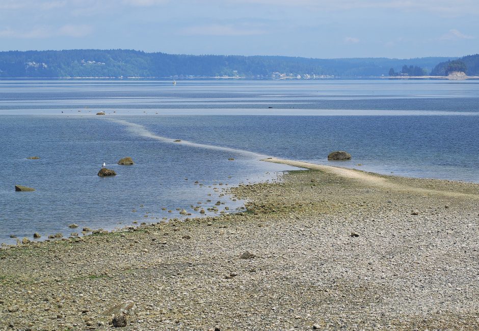
Shorelines being exposed during a low tide are not at all unusual around here. But this trail reveal was like a water clock of natural art, expressing the movement of the moon, Earth, sun and tides at human scale. It is superb.

High Tide & Lower High Tide? What?
This place had me thinking more about tides. We get two high tides a day and two low. The second highs and lows are normally of smaller magnitude. The high high makes sense. The gravity of the moon (and also the sun) bulges the water out closest to the moon (high tide), and flattens out on the sides of the Earth (low tide).

But why is the second high tide not as high? The lower high tide, is another lesser bulge of water out away from the Earth, but on the opposite side of the world as the moon, yet still caused by the gravity of the moon. What? How?

That's a brain twister to understand. Tidal Force is caused not just by gravity, but graduations in gravity strength around the world. Gravity has less force on masses that are further away. The water on the opposite side of the earth appears to bulge away from the moon, but really it is just being pulled toward the moon at a slower rate of speed than the rest of the earth, almost as though being drug behind. This produces a smaller bulge, hence a lower high tide.

Even other planets have tidal influence. The layout of the shoreline also greatly influences the timing and height of the tidal changes.

Watch the tide come and go sometime. You are witnessing our world and moon and sun hurling around each other and sloshing shit around! It's a marvel!
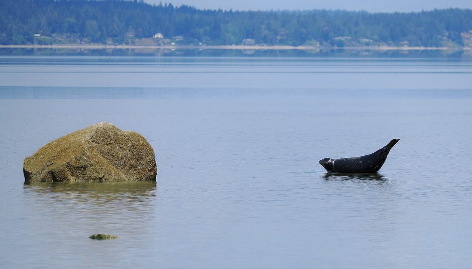
Out at the end of the tidal trail, trying not to get squirted by startled clams, I found what from afar looked like logs balancing on rocks, but it turned out to be resting seals.
I stayed two nights, and took a number of pictures in different lighting.
Night 5 – Lisabeula Park, Vashon – Via Tacoma Narrows – 20 Mile Row
I left Penrose early in the morning, with much more ease at high water. On this day I would be going through Tacoma Narrows. I was nervous because many years ago my wife and I were heading north through the narrows on a funky liveaboard motorboat. We had been living in Mud Bay at anchor while she attended Evergreen College.
I must have been dumb and came through when there was a strong current against a big headwind, and got our asses handed to us in some of the tallest, close-set waves I have ever experienced. We were taking lots of water over the bow, getting tossed all over the place and overall it was pretty miserable. And then our old motor decided it was hot enough and froze up, right in the middle of it. Obviously we survived, but were left scarred by this place.
Watch this video, that models the current flows through the narrows. All the water in south Puget Sound passes through this restricted channel; a lot of water, pumping through a very narrow place, at hard angles.
I planned this trip such that the current speeds would be low when I was going through the narrows, and going with me.
I had a lovely row across Carr Inlet to the northern tip of Fox Island, seeing many Dall’s Porpoise, seals and waterfowl along the way. There was no wind in the forecast. So I figured the narrows would be calm. But I still wondered if I should get my drysuit on. I talked to a local fishermen at the head of Fox Island, asking what I might expect, and he confirmed what I thought. It was going to be like floating a calm river. I continued on through Hale Passage and into the narrows.
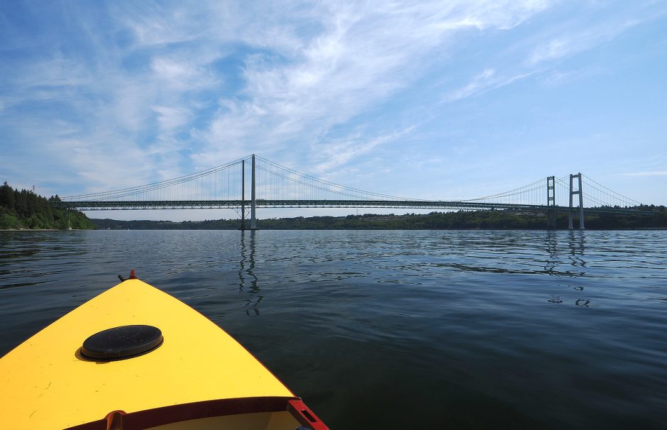
And it was calm. I hardly had to touch the oars, and enjoyed the ride, effortlessly heading north at two or three miles an hour, firing off a few quick pictures under the bridges as I whizzed by. The only bumps in the road came from boat wake. A number of big motor boats were bucking the tide, and thought they could find an eddy of opposite current close to shore, which was right where I was, heading the opposite direction. There was no eddy. Fortunately my boat is intentionally bright and easy to see on the water, and I had the VHF radio handy to communicate more verbally if they came too close.
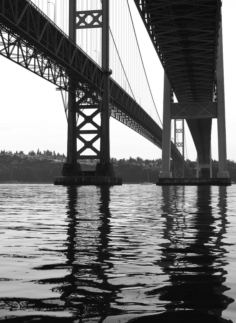
One of these bridges was built in 1950, the second in 2002. But there was an earlier bridge built in 1940, that was soon after known as Galloping Gertie, for its propensity to start violently twisting and jumping around when windy. Failing to fix the issue, just a few months later it collapsed. It’s remarkable to watch.
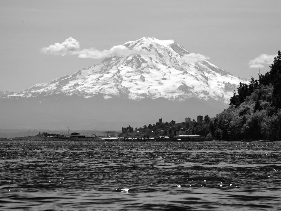
Exiting the narrows, even Point Defiance was devoid of the normal lumps and bumps of tidal chop. I was afforded a nice view of Mount Rainer just the other side of the narrows.
I continued heading north up the inside of Colvos Passage, which is one of those weird places in Puget Sound where the current mostly runs north, no matter a rising or dropping tide. Toward the end of my row a light headwind developed. But I was making good time. I put in ear buds, listening to good music to help with the work and distract from sore butt bones.
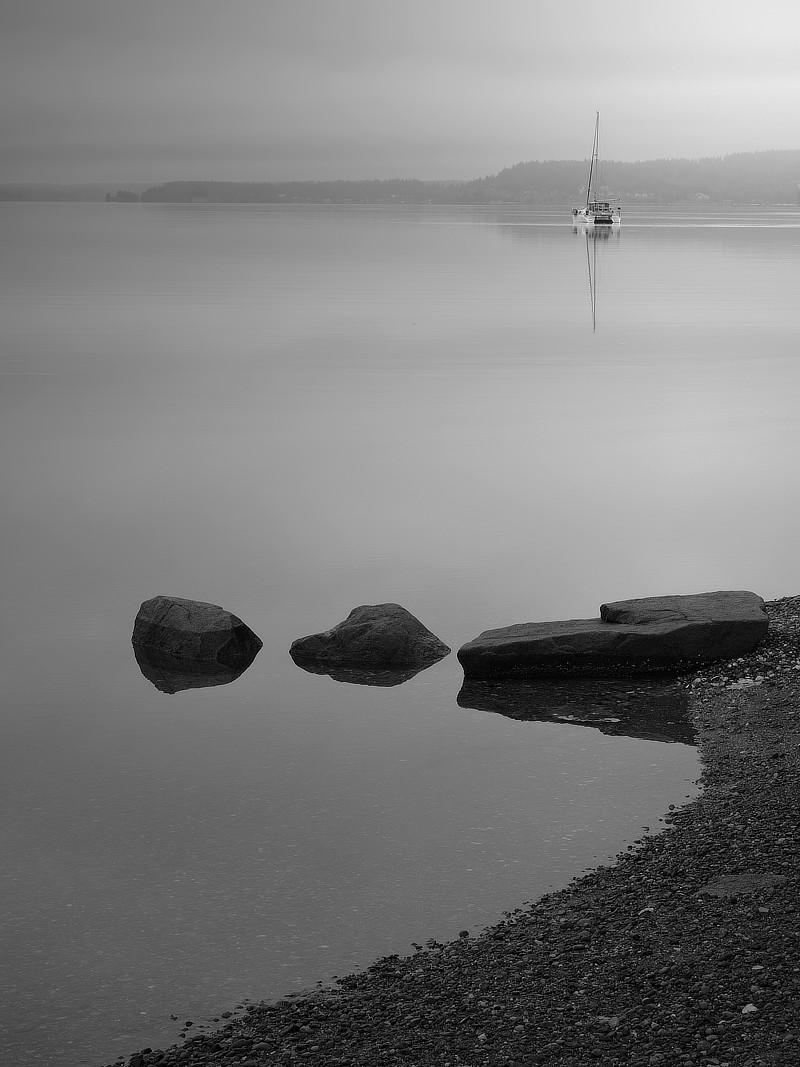
There was a big sailboat heading north with me, tacking back and forth across the channel. I imagine they were slightly surprised that I was holding steady with them over a number of miles, rowing directly upwind so covering less ground, tapping my foot and singing along to the tunes. By the time I made it to Lisabeula Park, midway up Vashon Island, I was wrecked. 20 Miles was another long row, even with the current.
Lisabeula is a nice little park, but small. You can only camp one night, by reservation. There is no drinking water, but there are porta-potties. There are some nice big trees in a deep valley behind the park, but really there is not much walking to be had, with private property all around. I was still very grateful for the resting spot.
Here I had a good conversation with a couple of young lads who grew up on Vashon. One of them had recently completed hiking 1,000 miles of the Camino de Santiago trail from Portugal to Spain, which sounds pretty damn fun. Every night he slept in a hostel. There is food available all along. So you have just a small day hiking sized pack. From them I also learned that Vashon Island is one of the best birding spots in WA.
I would like to explore Vashon more. Really this entire trip was reminding me of what a special place it is we live, and how many little islands and parks I have yet to explore.
Night 6 & 7 – Blake Island – 10 Mile Row
Once again I broke camp at the crack of dawn. My next destination was Blake Island. And I would be there at the beginning of Memorial Day weekend. Bad timing, but unavoidable. I was worried that I would not find a campsite unless I arrived as early as possible.
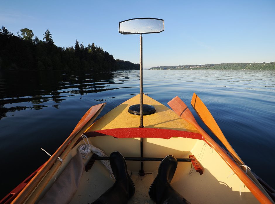
I had gorgeous light in the morning, no wind and a current running with me. I should have felt great. But something was off. I kept rowing into things, little logs and mooring balls, and had other near misses. I have never had a rowing mirror before this boat. And in these light conditions I could not see well enough with the mirror to trust it. If I ride up on a floating log I could capsize. And over the journey I had also noted that my eye was nearly always frozen to the mirror while rowing, which is frankly a crappy little thing to look at when the horizon is full of beautiful scenery.
So, much like my social media accounts, I took it down, and felt instant relief. Suddenly my view astern was no longer split. That damned thing had been fissioning my soul. I starting enjoying the scenery, and returned to a very natural panning of my view from left to right, back and forth, utilizing my peripheral vision. It felt great. I returned to twisting around regularly to get real eyes on the course and heading. That twisting is good for this slightly aging body. I realized I hate that mirror and doubt I will ever use it again. Good, one less thing. Next I might move my seat a bit to stern, let my feet push on the rear bulkhead, and tear out all that foot brace stuff. Other users with different length legs be-damned.
A kayaking friend of mine is bemused by my love of rowing, enjoying the view behind, using where I have been to keep lined up with where I want to go next, rowing merrily, blindly, into the future. Isn’t that life?

After sorting my mirror issues, the rest of my row to Blake Island was quick and enjoyable, with a short delay waiting for one of the Southworth catamaran fast ferries to leave the dock, heading for Fauntleroy.
Blake Island is a mixed place. I enjoy the beaches and forests, with miles of trails. There are some nice big trees on this island. But it is close to a number of cities on both sides, is easy to boat to, and so attracts a lot of both campers and day users. There is also a lot of marine traffic and WA State Ferries cruising around it. So the campgrounds are a bit loud and busy. The island is bustling, so I would prefer to visit it on the shoulder seasons, or weekdays at least.
But I made the best of it, walked just about every trail on the island, finding the Tillicum Village facilities closed up, apparently a causality of COVID.
Despite my internal complaints about all the people and boats I sure was chatting it up. At the seedy little marina I talked with the owners of a nice big wood motorboat, recognizing one of my favorite designers, Sam Devlin. They commonly have the craft in the Wooden Boat Festival in my home town, so I surely had seen it before.
I also made a new boating friend who arrived by paddle board and camped next to me. We had some good talks, and it was nice to see someone else out camp cruising in such a minimalist way. We were not alone in this. There was also a small group of kayakers camped in the Water Trail sites. I had splurged on an expensive campsite with a better beach and some shade.
There were many nurse stumps around the island, old giants giving life to new.

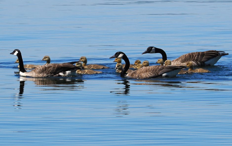
Despite all the boats and people around the island, there is still a decent amount of wildlife. Canada Geese seem to love the place, and there were many cute little goslings, as well as many other birds and seals.
In truth I prefer to be on the water alone, in wilderness, with few to no other boats. But that is a very rare thing. Of course I enjoy boat trips with friends as well. If it is a small group. But there is a different quality of intimacy, awareness, and connection with the natural world when alone, so most often I am alone.
Photography also works better alone. I make a poor walking partner with camera in hand, stumbling along slowly, looking at everything while trying to see nothing; light, color, line, shape and feeling.
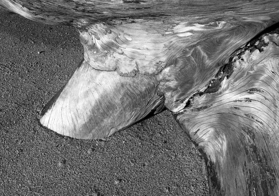
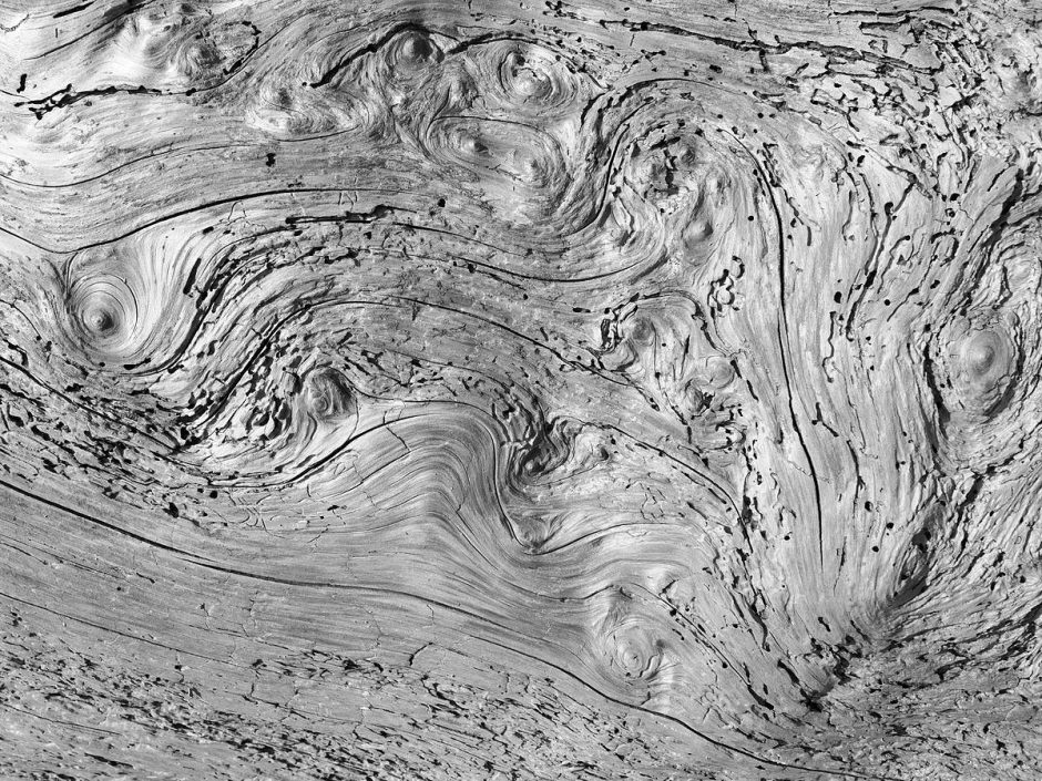
Once again, beach logs were compelling at Blake.
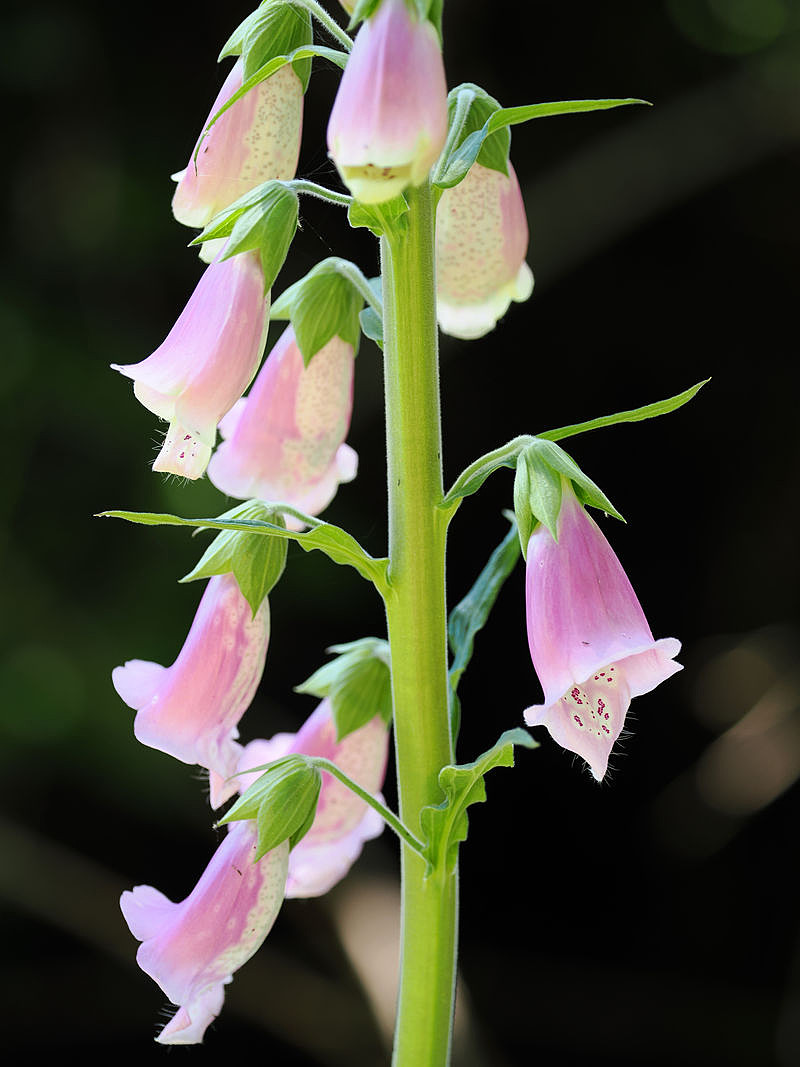
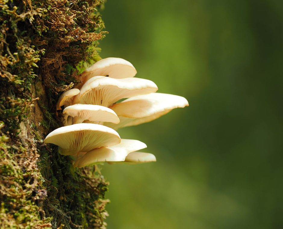
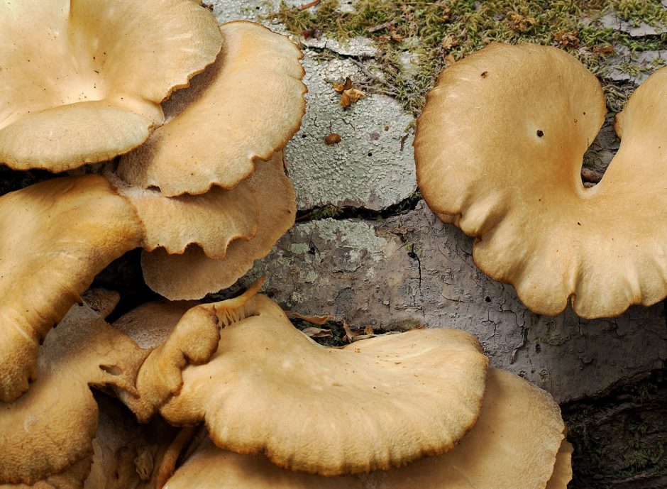
And other beautiful little things.
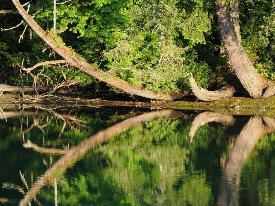
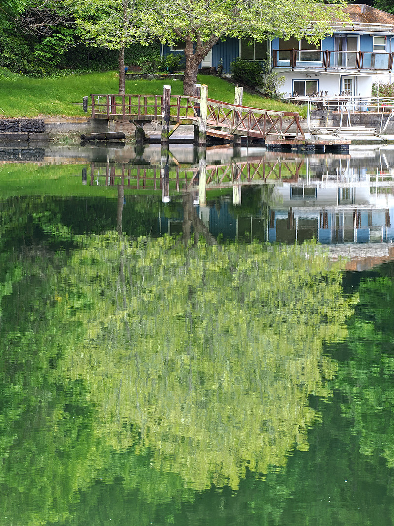
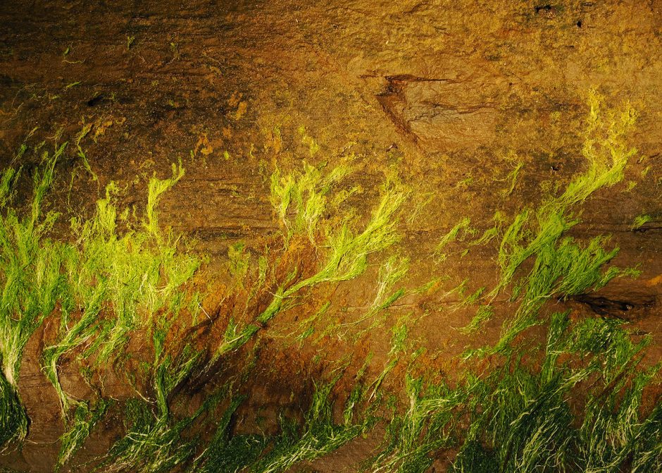
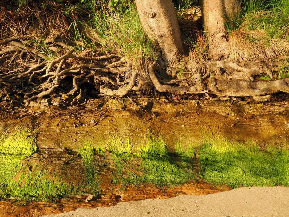
When the sun was low, it would reflect off the water, up under the tree canopy along the shoreline, lighting up some beautiful green growth on the rocks.
Day 8 – Poulsbo 10 Mile Row 4.5 Miles Sailed
As mentioned, originally my plan was to row back to Port Townsend. North from Blake Island, the route becomes less enjoyable and more dangerous, with more open water, ferries to dodge and big ship wake. And there would be a stretch between campsites requiring a 26 mile row, around one of the most dangerous spots for a small boat along the way, aptly named Foulweather Bluff, where the Hood Canal branches off and the ocean gets all bunched up, indecisive and pissy, particularly with the high winds forecast. After that I would be in home territory, that I have rowed and sailed in most often.
The thin attraction to finishing the trip that way would be for bragging rights, to say I had rowed the entire distance, which I just didn’t care about. So I let the strong winds of tomorrow blow me the way I really wanted to go today.
As was the pattern, to catch the tide, I left Blake Island fairly early, around 7am, which meant I was up at 5:30 am for breakfast, broke camp, got the boat down to the waterline, hauled my gear down and packed it, and hauled my body to the toilet to unpack it. I was headed for Rich Passage, a tight curving blind alley that is narrow and full of current, that the Bremerton to Seattle ferry runs through.
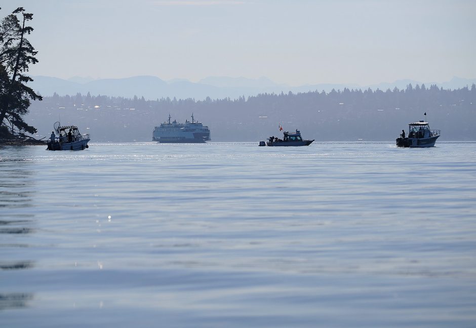
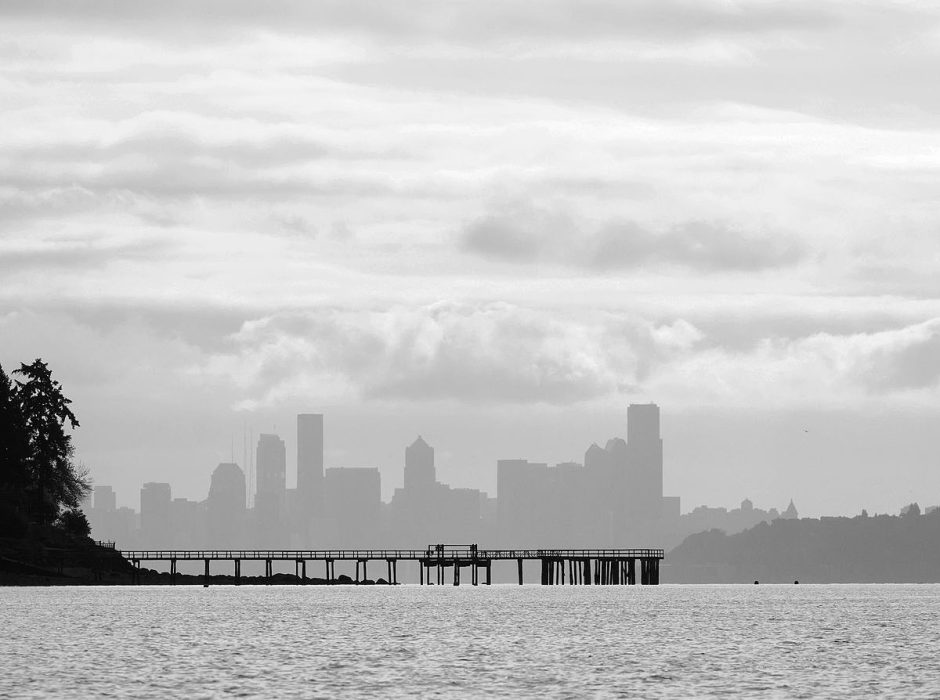
Washington State Ferries are deceptively fast, and sneaky. At first glance, they seem far away, uninterested, look back and suddenly they are pouncing, great metal hunting cats. So I edged up to the shipping lane just north of Blake Island, where I had decent visual range, to see if any ferries were on the stalk, and quickly rowed across. Then I hugged the south end of Bainbridge Island west through Rich Passage.

Along the way I came across Orchard Rocks Conservation Area, just covered in resting seals and immature eagles. You are required to keep out of a 400 yard circle around this rock. I drifted by, riding a slow current, and took some pictures.


Once I rounded Point White and was able to head north again up Port Orchard Passage, a nice little southern breeze picked up, and I put up my downwind sail for the first time of this trip. I have an extra oarlock socket further back on the boat that I can hang an oar off, turning it into a rudder.
If you are a sailor, you know the immediate sense of peace when the motor is turned off, and you are fully under sail, particularly downwind. I was surprised to find a similar feeling when taking a break from the oars. Turned around, sitting on the boat bottom with my back supported by the rear bulkhead, sailing easily along at a couple of miles an hour, it was a great pleasure. I sailed about 4.5 miles up to Battle Point.

It was still Memorial Day weekend, people were waking up and getting out on the water, and I was rather suddenly surrounded by a large number of big white wave machines, coming and going from Poulsbo, Agate Passage and from where I had just come. I dropped sail and returned to the oars for more control of the boat. The entire surface of this large bay was being turned into a turbulent washing machine. I was becoming a connoisseur of power boat wake.
Give me ferry wake any day of the week compared to this, which are like little gentle ocean swells. Our local ferries seem to part and close the water efficiently.
I was very pleased to find that this little boat was handling it all like a champion. Only once did I nose into a set of waves that were steep enough that they gave me concern. Otherwise this nicely rounded hull was not bothered by waves from any quarter. The lively little cork never took on a drop.
At one point I heard one big power boater hailing another on Channel 16, saying they were changing course because they said, in what sounded like shock, “there is a little row boat out here!” I got on the radio and thanked them. They replied with a toot of the horn and a wave out the window.
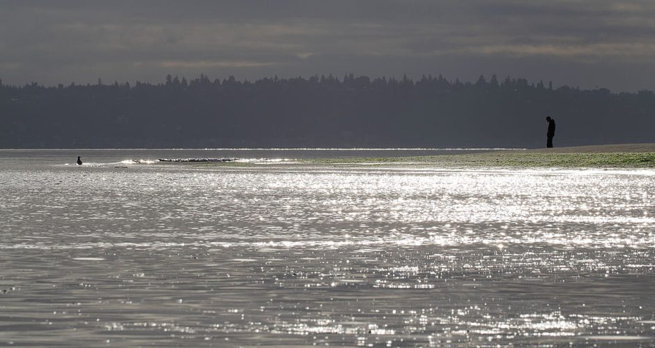
I was lilliputian, the only small boat on the water, let alone one under human or even wind power. The contrast was ludicrous. Only a very short time ago in human history we all got around on coastal waterways like I was doing. It’s so easy and fun.
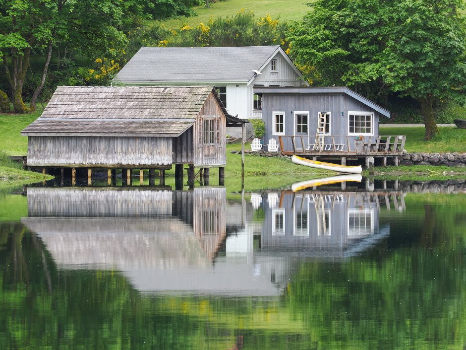
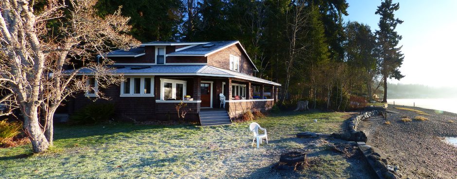
I arrived by about noon at my friend’s beach house. And it is a beach house in the truest sense. It was handmade by a distant grandfather, and somehow held and shared by a large family group for over a century for all to enjoy. It is small, and very rustic, its dirt driveway a winding maze between giant old growth fir and cedar. It is a place of endless memories for this family, memorials, weddings, parties and quiet times of relaxation; for myself as well. Only in recent years was it even insulated and dry-walled inside. Most of my life I recall it being bare studs, filled with cobwebs, dark inside, sleeping in the cold until you got the fireplace going. From the water it is so obviously a thing of the past, with big modern homes along the shore all around.
I have visited and played on the water here countless times in the last 38 years, and always desired to arrive by boat. After 70 miles covered, rich in experience, what a satisfying and apropos place to end my trip.
Thoughts On The New Boat (and maybe another???)
I am immensely pleased with the boat. It handled everything so well. I was not in good rowing shape. But I completed a 70 mile trip in so much ease, with so little drama, that I almost cannot fathom it. I did not even get a hand blister, just one little hot spot. I will change very little on the boat. Maybe I will make another set of oars, if I can find the right wood.
I mostly credit the success of this trip to the highly refined lines of this craft, so efficient and well tuned to the water, by a master designer from a century before, and am so grateful to my friends Rob & Allison for gifting me with its lines. And I must take a little credit. My own additions and modifications to the design gave me a great feeling of safety, and did not seem to detract from the boat’s performance at all. And I really like the looks of it. I expect to keep this one for a long time, exploring in it, listening to its songs of the ocean.
And now, you can all chuckle heartily at my expense and then go choke on it. On this trip I started thinking about building a smaller guideboat, in skin-on-frame construction, maybe 13′ in length, that could use the same oars, but would only weigh around 35 lbs. For day trip explorations it would be much easier to get up and down a beach.
More to come….
Comments or questions? Click here.
Get on the mailing list to receive notice of new posts here.
Sharing?
Please do share this webpage URL anywhere you like. Do not copy any pictures or content though, unless you enjoy copyright lawsuits.